Novikova N.M. ECOLOGICAL AND GEOGRAPHICAL ASPECTS OF THE ARAL SEA CRISIS. PART 3. RESEARCHES OF THE DYNAMICS OF THE NATURAL COMPLEXES OF THE ARAL SEA REGION // Ecosystems: ecology and dynamics. 2021. Vol. 5. No 3. P. 60-155. | Abstract | PDF | Reference |
-

-
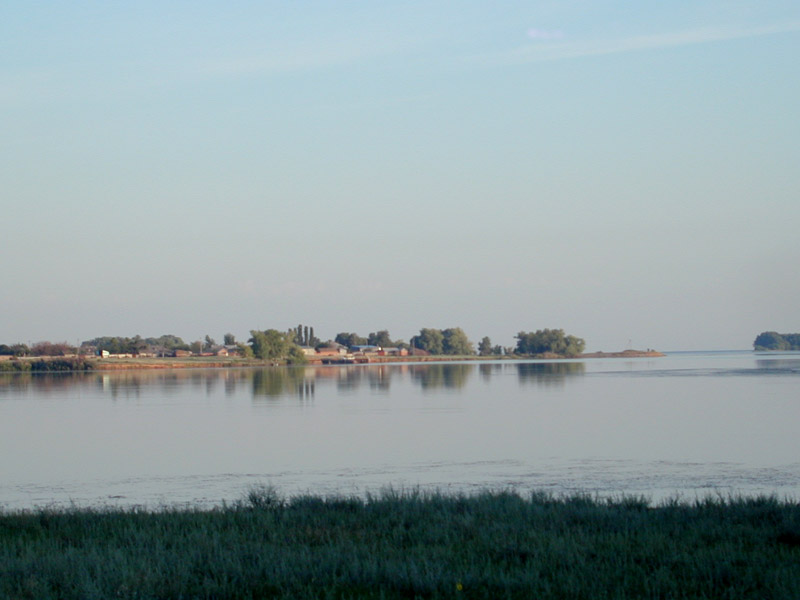
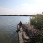
Akpetkinsky Archipelago, 2001 (photo by N.M.Novikova)
-

-
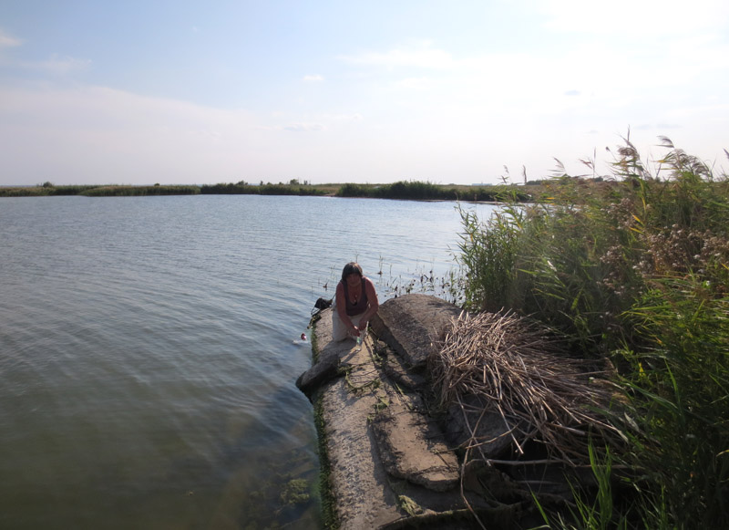
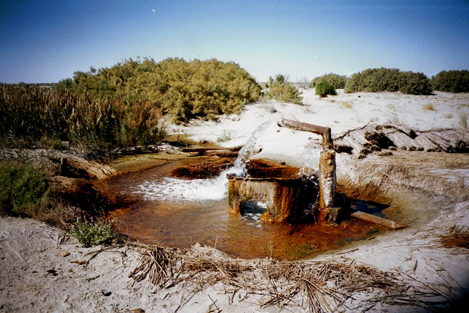
Self-flowing well, 2001 (photo by N.M.Novikova)
-

-
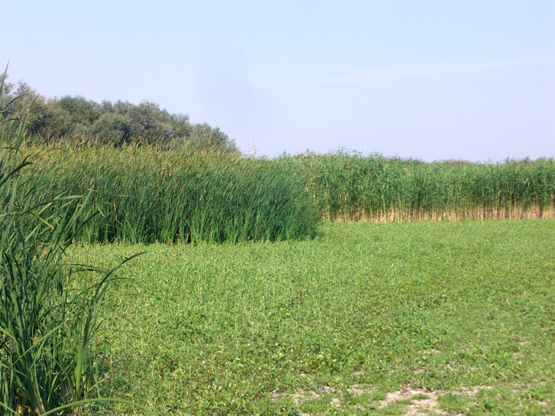
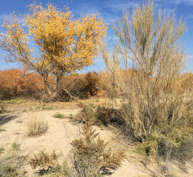
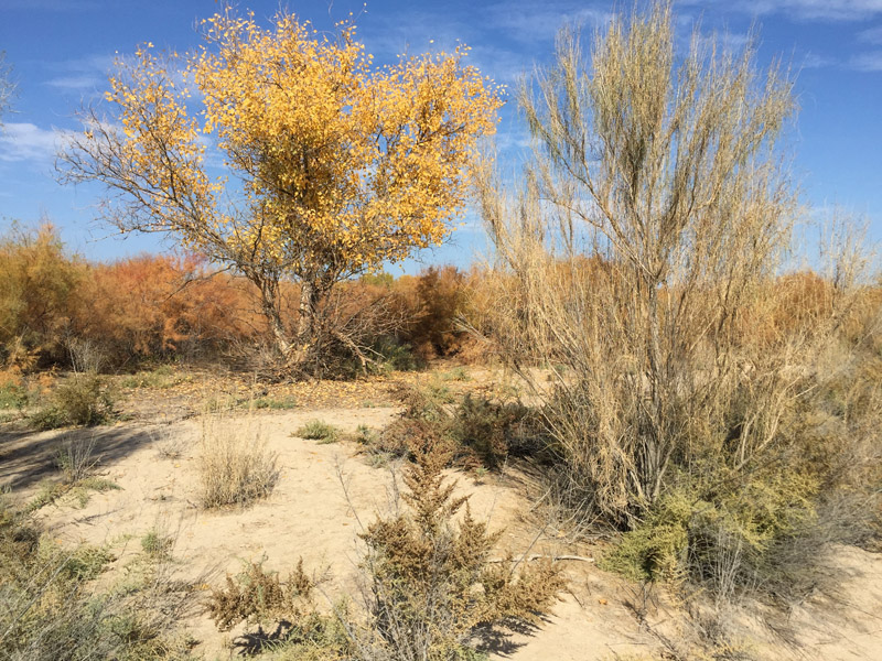
Black saxaul intruding into the Turanga tugai, 2017 (photo by N.M.Novikova)
-

-
Saline in the coastal part of the Amu Darya Delta, north of Kazakh Darya, 2017 (photo by N.M.Novikova)
-

-
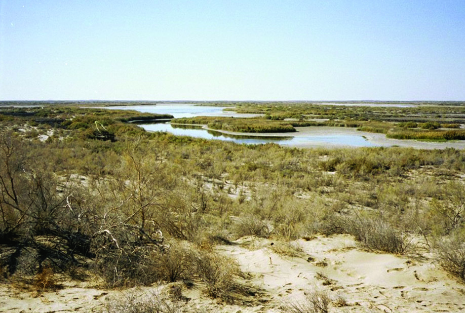
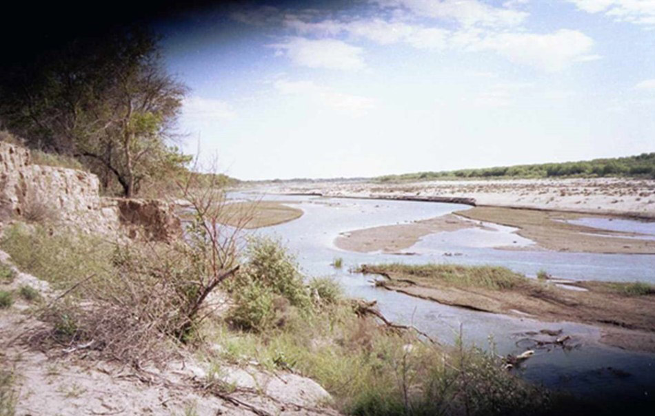
The affluent channel of the Amu Darya River near Porlytau, 1998 (photo by N.M.Novikova)
-

-
The shallow channel of the Amu Darya River near Porlytau, 2000 (photo by N.M.Novikova)
-

-
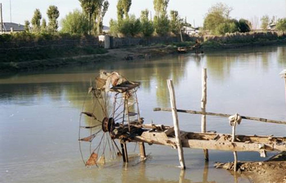
A construction for water intake from a channel in the Kazakhdarya Village, 2000 (photo by N.M.Novikova)
-

-
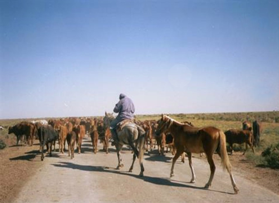
Herd in the valley of the Kazakh Darya channel, Amu Darya Delta, 1986 (photo by N.M.Novikova)
-

-
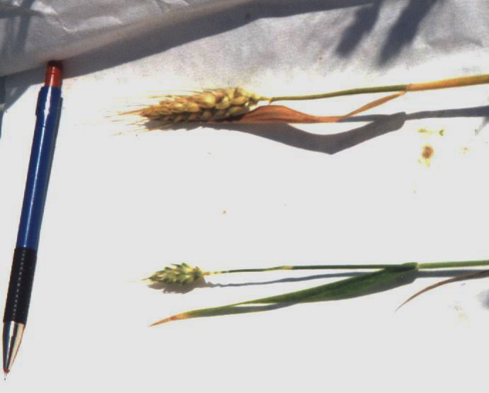
Blooming Elaeagnus angustifolia, 1986 (photo by N.M.Novikova)
-

-
Expedition on the dried seabed, 2001 (photo by N.M.Novikova)
This chapter of our article is devoted to the study of transformation processes of the natural complexes in the Aral Sea Region, due to the decreasing level of the sea and reduction of its water surface area. This territory was influenced by the development of the Aral Crisis. The anthropogenic transformation of natural complexes, considered to be a desertification, caused losses in their resource potential, and influenced the development of the medico-biological and socio-economic components of the problem. The article includes a review and discussion of the studies that were carried out on the dynamics of natural complexes by different authors, the novelty and originality of their approaches and methods, the scientific and practical significance of the results, and the contribution they did for futher understanding of the development of the Aral Crisis. First, we consider the complex landscape studies, then we discuss the studies of individual landscapes components, such as soils, vegetation, avifauna and animal population. We discuiss the studies of the dynamics of the said territory and its individual 5 landscape regions (Ustyurt, Northern, Eastern, South-Eastern and Southern Aral Sea). The main works and scientific publications were written about the Southern Aral Sea Region, especially its part of the delta of the Amu Darya River that has not been developed for irrigation use. All authors agree that the dynamics of the local natural complexes is a desertification process, caused by a reduction in the moisture supply of the territory in the arid climate. Landscape studies of the region (V.A. Popov (1990), A.V. Ptichnikov (1991), A.A. Rafikov and N.F. Tetyukhin (1981), G.V. Geldyeva et al. (1989, 2000)) were aimed at its spatial structure, identification of the processes and forms of desertification in different types of landscapes and landscape areas. It is shown that the modern landscapes of the Aral Sea Region are of different genesis, age and conditions. Therefore, the smallest changes in the conditions of the Aral Crisis are common for the older, desert landscapes, while the most severe are common for the youngest ones. A.V. Ptichnikov (1991) revealed that changes of individual components (such as vegetation, mainly) occurred in Ustyurt on the elevated plateaus of the Northern Aral Sea Region, and in the Kyzylkum. The changes of facies are common for a wide (up to 120 km) strip of ancient aluvial-delta plains and in a narrower (up to 20 km along the seashore) strip of sandy deserts in the Eastern Aral Sea Region, as well as on the chinks of the Ustyurt and the plateau of the Eastern Aral Sea. Changes in the tracts happen in the rivers floodplains and on the dried-up seabottom, as well as in the coastal strip of the ancient aluvial-delta takir plain of Akchadarya, 20-60 km from the coast of the 1960s. Changes in the morphological landscape units of complex tracts and areas are common for the non-irrigated parts of deltas, with the exception of floodplains adjacent to the main riverbeds. The highest rank of changes (change of landscapes) in the Aral Sea region occurred in the non-irrigated parts of the Amu Darya and Syr Darya deltas, as well as in the dried-up strip of the sea floor. In these studies, new remote sensing materials were used at that time, mapping methods were developed using them. The obtained results are reflected in various cartographic materials, their analysis shows that, unlike desert landscape areas, the modern dynamics of natural complexes of deltas is distinguished by the fact that they are under the influence of several factors and they are characterized by spatio-temporal heterogeneity. The scientific significance of the obtained results lies in the development of a theoretical understanding of the ecological and genetic series of delta landscapes as an evolutionary system that develops during the natural development of the territory in the direction of the formation of zonal variants. It is shown that the dynamics of landscapes in the conditions of the Aral crisis differs from the natural one by accelerating processes and skipping stages. The landscapes of the modern deltas of the Amu Darya and Syr Darya, having a natural tendency to desertification genetically determined and enhanced by the fall of sea level and the drying of the water mirror of the sea, are at different stages of this process, depending on the conditions of the water regime maintained by man when creating an artificial hydrographic network (a system of reservoirs and channels). The current soil cover and soil dynamics of the Aral Sea Region were studied in more details in the Amu Darya Delta during field observations by B. Zhollybekov from 1980 to the present day. They are reflected in a number of his publications (Zhollybekov, 1987, 1995). He studied and characterized the modern soil cover, formed an idea of the variants of transitions from one soil to another, and proposed a forecast of their development after 1990. Special attention in his research was paid to the processes of salinization-brining. In the studies of G.S. Kust (1999), the theory of litomorphopedogenesis was further developed in relation to the modern conditions of the Amu Darya and Syr Darya deltas. A proof illustration of this theory is the schemes of soil dynamics, vegetation and the main soil-forming processes developed by him for genetically different landscapes at different rates of change in moisture availability and salinity. It is shown that the takir-like and takir-like soils of the ancient delta plains of the Aral Sea (Akchadarya, Zhanadarya) are not the final stage of the development of initially hydromorphic alluvial-delta soils, since they are also a stage in the process of long-term evolution into gray-brown soils. Vegetation is one of the most important resources of the Aral Sea region, creating the economic well-being of the population and favorable living conditions. Therefore, when studying the dynamics of vegetation, in addition to traditional botanical indicators, species (floral) and phytocenotic richness, vitality, renewal, etc., economically significant indicators (aboveground and underground phytomass), the ratio of the species composition of plants of different economic groups were necessarily studied. A.B. Bakhiev (1985) and his colleagues (Bakhiev et al., 1977, 1994; Bakhiev, Butov, 1976; Bakhiev, Treshkin, 1995) studied the vegetation of the Amu Darya River delta (changes in its species richness and diversity) for a long time. N.K. Mamutov (1990) carried out a study of meadow vegetation and its economic significance in the Amu Darya Delta. As part of the UNESCO project (Novikova et al., 1998), an inventory of phyto-diversity (taxonomic and phytocenotic richness) was carried out, a modern classification was developed, the ecology of communities was characterized, and their dynamic state was evaluated. The scientific significance of these studies is associated with the development of theoretical ideas about phyto-diversity as a multi-level (taxonomic + syntaxonomic + chorological) dynamic (evolutionary) system associated with landscape diversity. This is illustrated by the model of dynamic relationships of plant communities. The practical way out of geobotanical studies is that the assessment of the state of vegetation cover in the modern Amu Darya delta for the mid-1990s is given, it is shown which groups of communities at the formation level have died, are at the stage of dying off, or have a tendency to expand. In addition, the results of the study provide a scientific justification for carrying out practical hydro-reclamation works that provide a variety of environmental conditions by the nature of humidification and salinization to preserve the entire variety of biotopes and biota. In these works it was proved for the first time that calculating the water balance of the territory of the Amu Darya Delta, biocomplexes should be taken into account as an independent separate water consumer. The vegetation of the Amu Darya and Syr Darya is tugai deltas, which is a special relict type of floodplain vegetation, with tree, shrub and grass communities. Studies by S.E. Treshkin and Zh.V. Kuzmina (Treshkin, 1990; 2011; Treshkin et al., 1998; Treshkin, 2000; Kuzmina, 1993, 1997b; Kuzmina, Treshkin, 1997a; Kuzmina, Treshkin, 2006) have shown that tugai vegetation, which is widespread outside the Aral Sea region in the floodplains of rivers in Central and Central Asia, is currently subject to degradation everywhere. The main reason is of anthropogenic kind; it is the regulation of dams and the reuse of river flow. The death of the Amu Darya tugai in the delta, which represent the greatest diversity and occupy vast areas in the basin, will lead to the loss of the species and phytocenotic richness of this type of vegetation. The ecosystem approach to the analysis of the dynamics of tugai was allowed by S.E. Treshkin and Zh.V. Kuzmina (Treshkin, 2011; Kuzmina, Treshkin, 2012) to substantiate the possibility and methods for their preservation. The existence of tugai communities is a guarantee of the preservation of the diversity of their animal population and species richness. This was confirmed by the works of T. Abdreimov (1981) and M. Ametov (1981) on inventory, as well as the work of R. Reimov (1985) on dynamics of the avifauna of mammals. After the researches that have been conducted since the late 1960s in the Aral Sea region and its individual landscape regions, the new knowledge about the ecological crisis and the features of its development was obtained, which can be represented as a chain of ecologically conditioned, consistently developing processes leading to the formation of natural complexes of the desert type. The studies have shown that by the 1990s, following the final transformation of the climate in the Aral Sea region, the landscape changes in the desert regions (Ustyurt, Northern and Southeastern Aral Sea region) were completed. In the North-Eastern and Southern Aral Sea Regions, in the territory of the deltas of the Amu Darya and Syr Darya Rivers, the desertification process has been suspended by hydro-reclamation transformations and the preservation of floodplain-alluvial processes in the local areas. The dynamic state of their natural complexes depends on the environmental conditions, determined by new water reservoirs. However, the existing systems do not provide the need for the development of floodplain complexes, which is the main ecological condition for their development. So, the stability of the delta ecosystem is preserved, provided that each site is at its own, different stage of development. In the absence of dynamics, the natural complexes will overgo a short evolution and complete it with the formation of halophilic biotic and abiotic complexes. This problem of maintaining the dynamic balance of delta ecosystems is an important task for management of the development of the Aral Crisis, therefore it is necessary to direct the geoecologists’ efforts to help with its solution. This article is relevant, because in a brief form and for the first time it reviews the studies on the dynamics of natural complexes and components of ecosystems under conditions of the developing Aral Ecological Crisis; their scientific novelty and theoretical significance for crisis understanding are assessed as well.
Keywords: Aral Sea Region, landscape areas, natural complexes, landscapes, soils, vegetation, avifauna, wildlife, processes, dynamics, evolution, desertification, water regime, ecological-dynamic, ecological-genetic series, biodiversity, economic significance, hydro-reclamation projects.
DOI: 10.24412/2542-2006-2021-3-60–155