CHANGES IN THE FLORA COMPOSITION OF PLANT COMMUNITIES IN THE SOUTHERN ARKHANGELSK REGION IN THE 20th CENTURY
Eremeeva E.A., Leonova N.B. Changes in the Flora Composition of Plant Communities in the Southern Arkhangelsk Region in the 20th Century // Ecosystems: Ecology and Dynamics. No. 3. 2022. P. 27-47. | Abstract | PDF | Reference |
- Study region on the modern map of Arkhangelsk Region is marked with a red circle
- Study region on a map of Vologda Governorate (Velsky Uezd) for the early XXI century borders (Stielers Hand-Atlas, 1905)
- Landscape of a moraine-erosion plain in the Ustyansky district (photo by N.B. Leonova)
- Upland dwarf shrubs-sphagnum swamp with pine on a watershed (photo by N.B. Leonova)
- Pine forest with dwarf shrubs-lichen in the Kokshenga River valley (photo by N.B. Leonova)
- Overgrowing fallows in the Zayachya River valley (photo by N.B. Leonova)
- Campanula latifolia L. is a species that can be found in the rare floodplain habitats since the times of I.A. Perfiliev and is registered in the “Red Data Book of the Arkhangelsk Region” (2020; photo by I. Dobromyslov)
- Lotus corniculatus L. on the field edge. This species is absent in I.A. Perfiliev’s list (photo by N.B. Leonova)
- Thickets of Heracleum sosnowskyi Manden. along the bank of the Ustya River, near Shangalysettlement (photo by N.B. Leonova)
Based on the analysis of floristic data for different periods of time, this work studies the species composition changes in plant communities of the middle taiga in the south of the Arkhangelsk Region. In accordance with the “Flora of the Northern Territory” by I.A. Perfiliev (1934-1936), we compiled a taxonomic list of higher vascular plants of the Ustyansky District, Arkhangelsk Region that were growing there in the early XX century, and then corrected it in accordance with modern taxonomic nomenclature. We also carried out a comparative analysis of the early XX century list and the modern one, compiled for the same territory, and found differences in their taxonomic, ecological, coenotic and geographical compositions, as well as in the groups of species that changed their presence/absence status. The taxonomic changes turned out to be a decrease in the list by 140 species of vascular plants from 95 genera and 41 families, while 69 species from 57 genera and 31 families were registered in the territory for the first time. Although the taxonomic spectra for both periods are generally similar, the study has revealed that Brassicaceae and Fabaceae taxa increased, but Cyperaceae, Ranunculaceae and Orhidaceae decreased. We calculated coefficients of floristic similarity, Spearman and Kendall coefficients of correlation, and the generic coefficient. According to Jaccard similarity coefficient, the correlation coefficients showed a weak relation, while the floristic lists were highly similar, but the generic coefficient has decreased. It may indicate that flora identity and biological diversity decline due to the environmental changes.
An analysis of the ecological and coenotic composition of vascular plants for both studied periods showed an increase of species of disturbed habitats and a decrease of those that were close to indigenous communities, such as nemoral, boreal and wetland.
Climate changes, in particular, the increase of average annual temperature and the sums of active temperatures over the studied period, affected the change in the floristic composition of plant communities. The number of cold-resistant species of a hypoarctic-boreal range decreased, while some heat-loving broad-leaved-forest-steppe and plurizonal species appeared. According to the distribution of the species numbers along the Landolt ecological scales, the number of species with a high need for warmth increased, as well as the number of mesoxerophytes. The proportion of alien species also increased, most of which coming from southerly regions: Galega orientalis Lam., Lupinus polyphyllus Lindl., Heracleum sosnowskyi Manden.
Keywords: E.A. Eremeeva, N.B. Leonova. Changes in the Flora Composition of Plant Communities in the Southern Arkhangelsk Region in the 20th Century // Ecosystems: Ecology and Dynamics. No. 3. 2022. P. 27-47..
DOI: 10.24412/2542-2006-2022-3-27-47
EDN: APMFXP
ON THE METHODOLOGY OF MONITORING OF THE LOCAL WATERLOGGING IN THE STEPPE ZONE AGROECOSYSTEMS
Novikova N.M., Volkova N.A., Nazarenko O.G. On the Methodology of Monitoring of the Local Waterlogging in the Steppe Zone Agroecosystems // Ecosystems: Ecology and Dynamics. No. 3. 2022. P. 68-86. | Abstract | PDF | Reference |
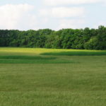
- Niduses of waterlogging on a slope (photo by N.A. Volkova)
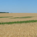
- Niduses of waterlogging on the slopes (photo by N.A. Volkova)
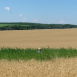
- Niduses of waterlogging in a landscape; a close-up of a permanent nidus (photo by N.A. Volkova)
- Niduses of waterlogging in a crease of a slope (photo by N.A. Volkova)
- Niduses of waterlogging in the amphitheaters with reeds (photo by N.A. Volkova)
- A close-up of the niduses of waterlogging (photo by N.A. Volkova)
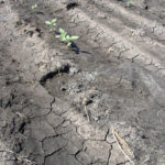
- Deterioration of crops due to a wash-out of their seeds and flooding of their seedlings (photo by N.A. Volkova)
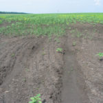
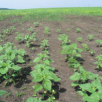
- Underdeveloped sunflower seedlings (photo by N.A. Volkova)
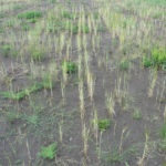
- Weeds intrude into the areas of sparse sunflower crops (photo by N.A. Volkova)
- Weeds intrude into cereals (photo by N.A. Volkova)
- A permanent nidus of waterlogging on an arable land with reeds and cocklebur (photo by N.A. Volkova)
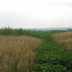
- Deteriorating crops; the lower ear has formed in a waterlogged area (photo by N.A. Volkova)
The local waterlogging in the south steppes of the European part of Russia is caused by the natural (climate fluctuation) and anthropogenic (total plowing) factors. The sizes of the transformed plots (“mochar”, i.e. pools) are unstable and relatively small (up to tens of thousands of square meters), but their total area in the field crops can be up to 15%, which causes undesirable changes in agroecosystems, such as crop loss and weeds distribution. A long-term study of mochar and the data on the reliability of a close relations between periods of exceeding values of the average annual precipitation, increasing area and intensity the nidus of local waterlogging, and distribution of hydro-halophilic plants (Phragmites australis, Elytrigia repens, Tripolium aster) according to the salinity level and soil moisture reserves, allowed us to develop a system of indicators and criteria for the methodology on the monitoring of the development of this phenomenon in a specific territory.
We suggest an algorithm, which includes identification of the areas, subject to local waterlogging, and study and evaluation of the natural complexes transformation within each area. The impact assessment is based on a system of biological and ecological criteria that indicate the hydrogenic transformation of the environment and the biota of agroecosystems such as groundwater, soil and vegetation. Combined, they make it possible to assess the degree and depth of the changes, to give recommendations for reducing or even ceasing the negative waterlogging processes, while forecasting the climatic trends. The novelty of this study is the aforementioned system of indicators and criteria, and the algorithm of monitoring based on our methodology.
Keywords: nidus of local waterlogging, indicators, plant species, soil subtypes, criteria, salinization, moisture reserves, water regime, hydro-halophilic vegetation, Rostov Region.
DOI: 10.24412/2542-2006-2022-3-68-86
EDN: HSZJZB
INDICATORS OF CHANGES IN POPULATION GROUPS OF MAMMALS IN THE INFLUENCE AREA OF THE ZEYA RESERVOIR UNDER THE IMPACT OF NATURAL AND ANTHROPOGENIC FACTORS
Podolsky S.A., Domanov T.A., Krasikova E.K., Levik L.Yu., Pavlova K.P. Indicators of Changes in Population Groups of Mammals in the Influence Area of the Zeya Reservoir under the Impact of Natural and Anthropogenic Factors // Ecosystems: Ecology and Dynamics. No. 3. 2022. P. 104-119. | Abstract | PDF | Reference |
- A male Siberian musk deer in the Ezo spruce forest (photo by S. Podolsky, taken with a camera trap)
- Female Siberian musk deer (photo by T. Domanov)
- Male elk in the valley of the Motovaya River during the rut (photo by S. Podolsky, taken with a camera trap)
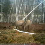
- Female elks in the valley of the Gilyuy river (photo by S. Podolsky, taken with a camera trap)
- A female elk in the oak forests of the Zeya Gorge (photo by S. Podolsky, taken with a camera trap)
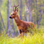
- Male Siberian roe deer on the shore of the Zeya water reservoir (photo by S. Podolsky)
- Male Siberian roe deer in the Zeya Gorge in May with still soft horns (photo by S. Podolsky, taken with a camera trap)
- A female Siberian roe deer with a one-year-old fawn (photo by S. Podolsky)
- Female Siberian roe deer in the valley of the Gilyui river in the late fall (photo by S. Podolsky, taken with a camera trap)
- Sable in the mountain tundra with thickets of dwarf cedar (photo by S. Podolsky)
- Sable with a vole it’s caught on the first snow in the Ezo spruce forest in late September (photo by S. Podolsky)
- The red-backed vole is one of the main prey of sable in the Zeya Reserve (photo by S. Podolsky)
Using the long-term data of the Zeya Nature Reserve, we accessed the natural and anthropogenic factors and their significance for the dynamics of the number of population groups of mammals in the influence area of the Zeya reservoir. Siberian musk deer (Moschus moschiferus), elk (Cervus canadensis), Siberian roe deer (Capreolus pygargus) and sable (Martes zibellina) were selected as model species. The anthropogenic part of population dynamics is defined on the basis of a comparative analysis of the long-term “test” (shore of the Zeya reservoir within the reserve territory), “control” (reserve territory outside the shores) and “background” (Amur Region) observations. We offer a step-by-step algorithm for studying mammals in the influence area of any large hydraulic structures. The first step is to restore the chronology of changes in the population density of the model species, then to determine the time needed for each species to partially adapt to the reservoir, which is as follows: musk deer – 30 years, elk – 25 years, roe deer – 28 years, sable – 20 years. The second step is to determine the leading natural factors of population dynamics. For musk deer, elk and roe deer the defining factor is precipitation in the early growing season of May and June, which determines the amount of winter food supply and the survival rate of young animals. For sable the factor is the dynamics of the total number of mouse-like rodents, which has a significant negative correlation with the cycles of solar activity and long-term trends of spring-summer precipitation. The third step is to determine the main factors of the influence that the reservoir causes on the population dynamics of the model species. For musk deer this is deteriorating conditions of protection, increasing mortality along the shoreline of an artificial reservoir due to various injuries, predators and epizootics. For elks this is the poaching activities and wolves that hunt them on the surface of the frozen reservoir. For roe deer this is the disrupted routes of seasonal migration, poaching and increasing hunting pressure from the predators. For sable it is the microclimatic influence of the reservoir that causes an increase in morbidity and depletion of the food supply due to decreasing numbers of mouse-like rodents. The fourth step is to identify common signs of the hydro construction impact on any mammals. Each model species found in the influence area of the Zeya reservoir experiences prolonged population depressions, low level of correlation between population dynamics and changes in the main limiting natural factors, reduced population density, and increased amplitude of population fluctuations. The fifth step is to quantify the impact the reservoir has on the model species. We used such index as the difference between the average (over the adaptation period) population density on the “control” plots and on the reservoir coast, in % of the “control” level. The average annual losses were 51.8% for Siberian musk deer, 51.2% for elk, 78.1% for Siberian roe deer, and 35.4% for sable. While being under protection, each of these model species was able to partially adapt to the Zeya reservoir over 20-30 years; their population dynamics generally recovered, but the density and migration activity remained significantly lower than it was before the construction of the reservoir.
Keywords: hydro construction, impact assessment, model species, Siberian musk deer, elk, Siberian roe deer, sable, mouse-like rodents, population dynamics, solar activity, precipitation.
DOI: 10.24412/2542-2006-2022-3-104-119
EDN: KJNMJP
ECOSYSTEMS OF THE BAIKAL BASIN: DIGITAL MAP AND GEOINFORMATION DATABASE
Bazha S.N , Andreev A.V., Bogdanov E.A., Danzhalova E.V., Drobyshev Yu.I., Petukhov I.A., Rupyshev Yu.A. Ecosystems of the Baikal Basin: Digital Map and Geoinformation Database // Ecosystems: Ecology and Dynamics. No. 3. 2022. P. 120-171. | Abstract | PDF | Reference |
- Baikal Lake in Buryatia (all photos are provided by the authors)
- Barguzin Range
- The Selenga River near the Russian-Mongolian border
- The Delger-Muren River in its middle reaches
- The Ider River at the foot of the Tarbagatai Ridge
- Khuvsgul Lake
- The Zelter River
- The tectogenic canyon of the Orkhon River
- Kobresia meadows in the Khangai Mountains
- Larch-cedar forest on the slope near the Jargalant Ridge top (Northeastern Khangai Mountains)
- Leymus-halophytic-herb-Stipa splendens solonchak meadow on the terrace floodplain of the Orkhon River
- Foothill pastures in the eastern Khangai Region (Tevshrulekh somon)
The digital map “Ecosystems of the Baikal Lake Basin” (scale 1:500000) was compiled by deciphering the actual satellite imagery, while using the previously created materials of thematic mapping of various scales, obtained for different territories within the basin, as well as the authors’ field descriptions of ecosystems and vegetation. The map shows composition, structure, current state of terrestrial ecosystems, and new areas of anthropogenic ecosystems that have greatly expanded in comparison with the mapping data of previous years. The legend of the map includes 71 samples of ecosystems, which correspond to the landscape units “stow/sub-stow”.
To display the spatial variability of the natural components of ecosystems, the corresponding digital layer maps (combined GIS) were developed for morphogenetic types of relief, soil cover and vegetation of the basin, developed on the basis of interpolation of various published thematic data and supplemented with information from archives and materials from more than 50 years of field study of soils and vegetation cover by the Joint Russian-Mongolian Complex Biological Expedition of the Russian Academy of Sciences and the Academy of Sciences of Mongolia (JRMCBE).
The created spatial database of 5.1 GB is a cartographic Web service. It is intended for open use on any personal computers, workstations, laptops, tablets, smartphones running Windows and Android, including mobile ones with Internet access. The database includes spatial information on ecosystems and their anthropogenic disturbance on 9 model polygons (1:200000 and larger scales) and 9 key areas (1:5000 to 1:10000 scales), as well as from 1757 geobotanical descriptions.
Keywords:S.N. Bazha, A.V. Andreev, E.A. Bogdanov, E.V. Danzhalova, Yu.I. Drobyshev, I.A. Petukhov, Yu.A. Rupyshev. Ecosystems of the Baikal Basin: Digital Map and Geoinformation Database // Ecosystems: Ecology and Dynamics. No. 3. 2022. P. 120-171..
DOI: 10.24412/2542-2006-2022-3-120-171
EDN: FZDSSD


