↓
 

ISSN: 2542-2006

Ecology and dynamics

Just another WordPress site

Ecology and dynamics
  • Main page
  • Contacts
  • Open Access
  • Archive
    • Opening Statement of the Editor-in-Chief
    • Articles
      • Articles. No.3, 2019
      • Articles. No.4, 2019
      • Articles. No.1, 2020
      • Articles. No.2, 2020
      • Articles. No.3, 2020
      • Articles. No.4, 2020
      • Articles. No.1, 2021
      • Articles. No.2, 2021
      • Articles. No.3, 2021
      • Articles. No.4, 2021
      • Articles. No.1, 2022
      • Articles. No.2, 2022
      • Articles. No.3, 2022
      • Articles. No.3, 2022
      • Articles. No.1, 2023
      • Articles. No.2, 2023
      • Articles. No.3, 2023
      • Articles. No.4, 2023
      • Articles. No.1, 2024
      • Articles. No.2, 2024
      • Articles. No.3, 2024
      • Articles. No.4, 2024
    • Issues
      • Issues for 2017
      • Issues for 2018
      • Issues for 2019
      • Issues for 2020
      • Issues for 2021
      • Issues for 2022
      • Issues for 2023
      • Issues for 2024
      • Issues for 2025

Архив метки: water factor

LONGTERM MONITORING OF THE LOWER VOLGA VALLEY

Ecology and dynamics Опубликовано 6 ноября, 2024 автором admin10 декабря, 2024

Golub V.B. Longterm Monitoring of the Lower Volga Valley // Ecosystems: ecology and dynamics. No 2. 2024. P. 4-41. | Abstract | PDF | Reference


Satellite image (Google.Earth, 2024) of an abandoned and overgrown with woody vegetation area in the irrigated arable land, west of the Volga River delta
The bank of Akhtuba River, now used by people for recreation, in the middle of the Volga-Akhtuba floodplain, with plant communities of cl. Salicetea purpureae, August 2011 (photo by V.B. Golub)
A meadow with a borehole, south of the Volga-Akhtuba floodplain, 08/12/2010 (photo by V.B. Golub)
Schematic map of the Volga-Akhtuba floodplain. Legend: A, C, D, F, G – transects made by the Pre-Caspian Expedition of the Moscow State University; В, Е, Н – transects made by the All-Union Aerogeological Trust; numbers – stationary sample sites of the Yuzhgiprovodkhoz Institute and All-Union Aerogeological Trust

Soil map (superimposed on the topographic map) of the sample site near the Semenovskiy strait, where relevés were carried out
Satellite image (Google.Earth, 2024) of the sample sites near the Khora strait, Krugly Churakov Lake, the “Pastukhova Tonya” common, the Petropavlovka–Dosang transect, and the Astrakhan gas condensate complex (dotted line). The sample sites numbers correspond to those in Table 3
Schematic map of the delta of the Volga River. Legend: I – group of transects in the eastern part of the delta; numbers – stationary sample sites of the Astrakhan State Pedagogical Institute, – dam of the water divider
Algae on the meadow grass in the Volga River delta after a lasting flood, August 1979 (photo by V.B. Golub)

The construction of dams on rivers for hydropower, flood control, irrigation and water supply are a widespread phenomenon in the world. Natural complexes above the dams, which were created over thousands of years, are completely destroyed now. The reservoirs affect the regime of water flow in the river downstream of the dam, and these changes disrupt the functioning of natural ecosystems in the remaining areas of river floodplains.

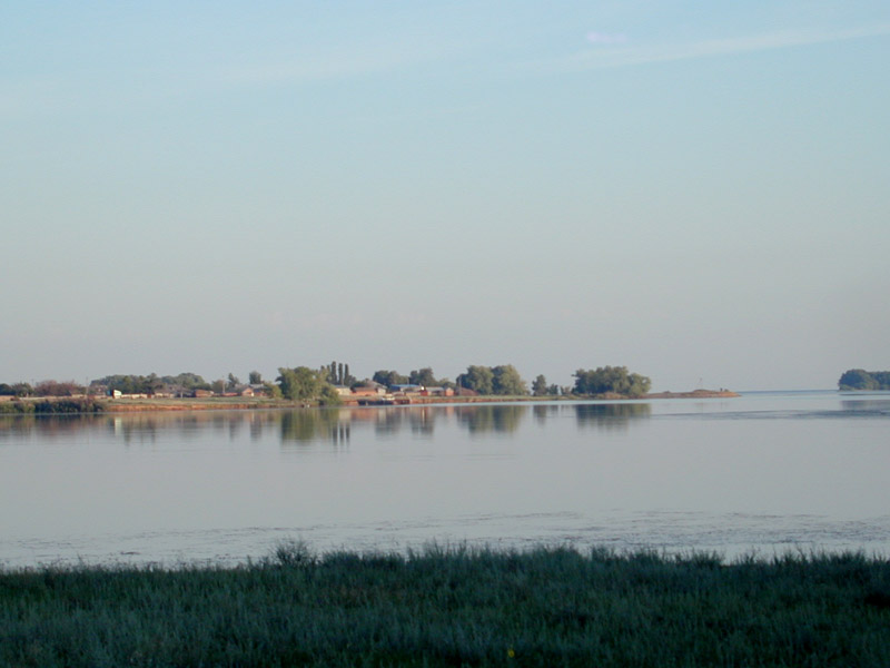
The Volga River did not escape the fate of transformation. It was converted into a reservoir system by the late 1960s. Filling of the reservoirs with water destroyed all natural ecosystems in their beds. Howevr, there is an exception, the lowest section of the Volga River valley, about 500 km long from the Volgograd Hydroelectric Power Plant to the Caspian Sea. This area is known as the Volga-Akhtuba Floodplain and the Volga River Delta, and we call it the Lower Volga Valley. It’s watered through the special spring-summer water releases into the lower pool of the Volgograd Reservoir.

In the 1960s, a project was planned out to create the Nizhnevolzhskaya Hydroelectric Power Plant in the Volga-Akhtuba floodplain. According to one of its options, the entire floodplain was supposed to become the bottom of the new reservoir. To compensate for the losses in the local fishery industry, a water divider would be built. Its function was to redirect water during floods to the eastern part of the delta and create a favorable habitat for the spawning of semi-anadromous fish. Meanwhile, the western part of the delta was planned to be transformed into the intensively used irrigated agricultural plantations.

However, due to the loss of large areas of agricultural land the idea of the Nizhnevolzhskaya Power Plant was abandoned. Only some of the projects, such as the water divider and transformation of the wetlands and meadows in the western delta, were fulfilled. Then, in the late XX century, during the transition from a planned Soviet economy to a market system, both the divider and the irrigation systems were abandoned and destroyed.

The first goal of this study was to characterize the materials stored at the Institute of Ecology of the Volga River Basin in order to monitor the dynamics of plant cover and partly soil cover of the Lower Volga valley. This material is of a great value as it has 15,675 geobotanical relevés of sample plots made in the valley in 1924-2023. For about 10,000 of them, the exact geographical coordinates were obtained.

The second goal of the article was to briefly summarize the results of a long-term monitoring of vegetation dynamics in the valley. The main results (since the 1970s) of this monitoring are also presented below.

We discovered that even after exclusion of the western part of the delta, its natural vegetation was preserved in the remaining territory nonetheless, although in a modified form. We also found out that such determining factor as the hydrological regime of the Lower Volga valley is not the only one that affects the vegetation cover and its productivity. Other significant factors are, for example, peculiarities of economic land use and invasions of alien plant species.

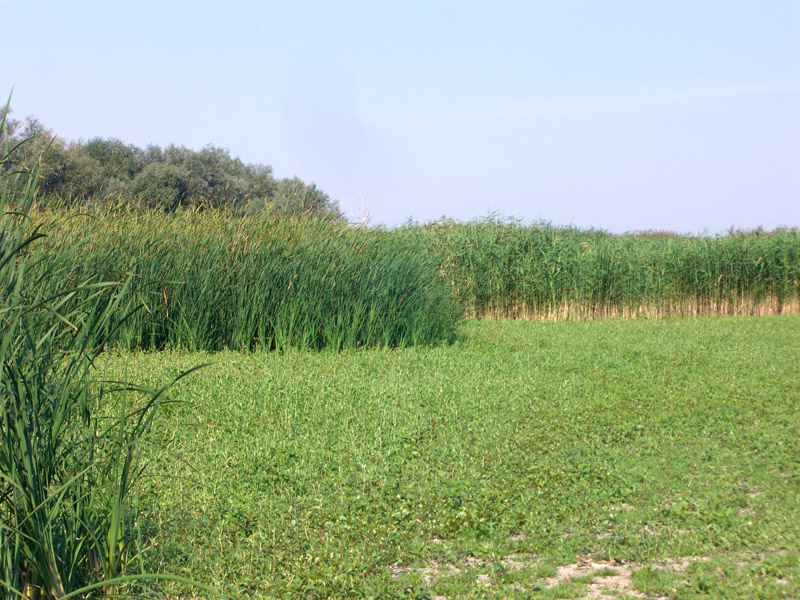
The Volga-Akhtuba floodplain underwent xerophytization and synanthropization of its vegetation cover which is especially noticeable in its northern part. Meanwhile, in its western part, where the irrigation systems were destroyed, large areas turned into fallow lands with specific type of vegetation.

Most importantly, its eastern part has transformed differently compared to the floodplain. There, the vegetation changed greatly between the 1980s and the early XXI century; reed and cattail thickets spread over large territories, and the area of halophytic phytocenoses decreased sharply. The main reasons for this were the increase in water flow of the Volga River at the end of the 1970s, and the cessation of hay harvesting for farm animals and reed for industrial use. Some recent changes towards xerophytization in the delta occurred only on the slopes of the Baer hillocks where the representation of xerophytic plant communities has increased, while the communities has spread down the slopes, which can be explained by climate aridization.

In conclusion, the author would like to emphasize that it is necessary to organize constant observations of the aforementioned phenomena and processes taking place in the region. This is important to justify and make management decisions on the conservation of biodiversity and biological productivity of ecosystems in the Lower Volga valley.

Keywords: Volga-Akhtuba floodplain, Volga River delta, regulation of water flow, stationary observation sites, lower pools of the hydroelectric system, reduction in flow volume, water factor, vegetation, xerophytization, anthropogenic factors, Volgograd reservoir, reed thickets, fires, soil desalinization, climate aridization.

DOI: 10.24412/2542-2006-2024-2-4-41

EDN: FRALCL

Метки: anthropogenic factors, climate aridization, fires, lower pools of the hydroelectric system, reduction in flow volume, reed thickets, regulation of water flow, soil desalinization, stationary observation sites, vegetation, Volga River delta, Volga-Akhtuba floodplain, Volgograd reservoir, water factor, xerophytization

ENVIRONMENTAL CONSEQUENCES OF THE CREATION AND OPERATION OF RESERVOIRS IN THE STEPPE ZONE

Ecology and dynamics Опубликовано 27 декабря, 2023 автором admin8 апреля, 2024

Danilov-Danilyan V.I., Novikova N.M., Nazarenko O.G. Environmental Consequences of the Creation and Operation of Reservoirs in the Steppe Zone // Ecosystems: ecology and dynamics. No 4. 2023. P. 5-28. | Abstract | PDF | Reference


Volga-Don shipping canal (photo by N.M.Novikova)
Tsimlyansk reservoir near the dam (photo by N.M.Novikova)
Tsimlyansk reservoir at dawn near Zhukovsky settlement, 2006 (photo by N.M.Novikova)
Tsimlyansk reservoir at sunset near Zhukovsky settlement, 2006 (photo by N.M.Novikova)

Collapsed shore of the Tsimlyansk reservoir near the Khoroshovo settlement, 2006 (photo by N.M.Novikova)
Collapsed shore of the Tsimlyansk reservoir near the Tsimlyansk city (photo by N.M.Novikova)
Stabilized shore of the Tsimlyansk reservoir (photo N.M.Novikova)
Exposed bottom of the Tsimlyansk reservoir near the dam, summer 2011 (photo by N.M.Novikova)

Exposed and overgrowing bottom of the Tsimlyansk reservoir (photo by N.M.Novikova)
Exposed bottom of the Tsimlyansk lagoon overgrowing with bulrush (photo by N.M.Novikova)
Exposed bottom of the Tsimlyansk lagoon overgrowing with willows (photo by N.M.Novikova)
Exposed bottom of the Tsimlyansk lagoon overgrowing with reeds (photo by N.M.Novikova)

Water and soil sampling at the Tsimlyansk reservoir (photo by N.M.Novikova)
Flowering tamarisks on the southern coast of the Tsimlyansk reservoir (photo by N.M.Novikova)
Cattle grazing in the water protection zone at the Tsimlyansk reservoir (photo by N.M.Novikova)
Veselovsk reservoir (photo by N.M.Novikova)

Crops irrigated with water from the Veselovsk reservoir (photo by N.M.Novikova)
Water sampling at the Veselovsk reservoir (photo by N.M.Novikova)
Shore of the Proletarsk reservoir (photo by N.M.Novikova)

Water reservoirs are so common worldwide that the changing they bring have reached a planetary scale. Water regimes are changing in the basins and on the shores of reservoirs, along the rivers and all the way to river deltas and receiving water bodies. Ecological consequences, i.e. a response of ecosystems and their components to changes in the water regime, are expressed in the increase or decrease of water availability, depend on the landscape and have zonal specificity.

Our research explores the largest reservoirs in the steppe zone of the European part of Russia, in the deltas of the Volga and Amu Darya rivers, and the Aral Sea Region. Additionally, we have analyzed an extensive list of scientific literature for the article.

In modern steppe landscapes, reservoirs are an important factor transforming the natural environment. Under the influence of changes in the regime of river runoff, the hydrogenic transformation of landscapes came to its end on the shores of reservoirs, i.e. natural complexes that are adapted to annual flooding have been formed on their shores. Meanwhile, their exposed bottoms become overgrown with pioneer communities, the long-term dynamics of which depends on annual water level fluctuations.

Artificial reservoirs are the reason for formation of hydromorphic biotopes in arid conditions of the steppe zone that are rarely found in natural conditions, and also for a maintained natural biodiversity of soils, vegetation and animals.

Negative ecological consequences in the lower pools of reservoirs in the steppe zone are especially strong in the river deltas and receiving water bodies. They are caused by changes in water regime and increasing irretrievable and partial withdrawal of river runoff due to cascades that have appeared on the rivers after an arid warming in the river basins.

Environmental protection activities to mitigate or completely eliminate these negative consequences are based on the management of the volume, regime and quality of river runoff directed to the lower pools of hydrosystems. For Russia, schemes of integrated use and protection of water bodies, as well as norms of permissible impact of economic and other activities on water bodies, including permissible irretrievable withdrawal of runoff, environmental flow and water releases, have been developed. However, our studies showed that ecological runoff (including release of water) is not carried out in most river basins which worsens the condition of aquatic and floodplain ecosystems. There are water protection zones on the shores of reservoirs, up to 200 m wide on the largest reservoirs. We found out that this protection zone is smaller than the influence zone of reservoirs on the shores, which manifests itself in backwater and groundwater dilution: zone of the Krasnodar reservoir is from 25 to 560 m, about 300 m on the Tsimlyansk reservoir, up to 540 m on the Veselovsk reservoir, and 13 to 107 m on the Proletarsk reservoir. It is practical to set the width of the protection zone along the boundary of direct impact of the reservoir.

At the same time, the natural complexes forming on the coasts become biomeliorants, i.e. they prevent pollution, siltation and depletion of water bodies. These complexes hinder erosion, maintain stable hydrochemical regime and biodiversity of coastal aquatic ecosystems, which are limited in the steppe zone.

Keywords: water reservoir, upper and lower pools of the hydroelectric system, river deltas, receiving water bodies, water regime, runoff volume reduction, water factor, hydromorphic soil indices, vegetation, animals, evaluation criteria, ecological consequences, salinization, environmental protection measures, steppe zone.

Funding. This work was carried out as part of the state task No. FMWZ-2022-0002 for the Water Problems Institute of the Russian Academy of Sciences “Studies of Geo-Ecological Processes in Hydrological Systems of the Land, Formation of Surface Water and Groundwater Quality, Problems of Water Resources and Water Use Management under Climate Change and Anthropogenic Impact”.

DOI: 10.24412/2542-2006-2023-4-5-28

EDN: XWGHVM

Метки: animals, ecological consequences, environmental protection measures, evaluation criteria, hydromorphic soil indices, receiving water bodies, river deltas, runoff volume reduction, salinization, steppe zone, upper and lower pools of the hydroelectric system, vegetation, water factor, water regime, water reservoir

About the Journal

  • General Information
  • Open Access
  • Editorial Board
  • Editorial Policy
  • Editorial Ethics

Submission of the Articles

  • Guideline for writing an article
  • Guidelines for Submission
  • Guidelines for Design
  • Guidelines for Abstract

Reviewing

  • Guidelines for Reviews

Archive

  • Opening Statement of the Editor-in-Chief
  • Articles
    • Articles. No.3, 2019
    • Articles. No.4, 2019
    • Articles. No.1, 2020
    • Articles. No.2, 2020
    • Articles. No.3, 2020
    • Articles. No.4, 2020
    • Articles. No.1, 2021
    • Articles. No.2, 2021
    • Articles. No.3, 2021
    • Articles. No.1, 2023
    • Articles. No.2, 2023
    • Articles. No.3, 2023
    • Articles. No.4, 2023
    • Articles. No.1, 2024
    • Articles. No.2, 2024
    • Articles. No.3, 2024
  • Issues
    • Issues for 2017
    • Issues for 2018
    • Issues for 2019
    • Issues for 2020
    • Issues for 2021
    • Issues for 2022
    • Issues for 2023
    • Issues for 2024
    • Issues for 2025
  • Photos
  • Events
©2025 - Ecology and dynamics - Weaver Xtreme Theme
↑