↓
 

ISSN: 2542-2006

Ecology and dynamics

Just another WordPress site

  • Main page
  • Contacts
  • Open Access
  • Archive
    • Opening Statement of the Editor-in-Chief
    • Articles
      • Articles. No.3, 2019
      • Articles. No.4, 2019
      • Articles. No.1, 2020
      • Articles. No.2, 2020
      • Articles. No.3, 2020
      • Articles. No.4, 2020
      • Articles. No.1, 2021
      • Articles. No.2, 2021
      • Articles. No.3, 2021
      • Articles. No.4, 2021
      • Articles. No.1, 2022
      • Articles. No.2, 2022
      • Articles. No.3, 2022
      • Articles. No.3, 2023
      • Articles. No.1, 2023
      • Articles. No.2, 2023
      • Articles. No.3, 2023
      • Articles. No.4, 2023
      • Articles. No.1, 2024
      • Articles. No.2, 2024
      • Articles. No.3, 2024
      • Articles. No.4, 2024
      • Articles. No.1, 2025
      • Articles. No.2, 2025
      • Articles. No.3, 2025
      • Articles. No.4, 2025
    • Issues
      • Issues for 2017
      • Issues for 2018
      • Issues for 2019
      • Issues for 2020
      • Issues for 2021
      • Issues for 2022
      • Issues for 2023
      • Issues for 2024
      • Issues for 2025
      • Issues for 2026

Архив метки: saline soils

METHODOLOGICAL APPROACHES TO ASSESSING THE STATE OF IRRIGATED LANDS IN THE DRY STEPPE ZONE OF THE VOLGOGRAD REGION USING SATELLITE IMAGES

Ecology and dynamics Опубликовано 26 марта, 2023 автором admin4 июля, 2023

Gorokhova I.N., Pankova E.I. Methodological Approaches to Assessing the State of Irrigated Land in the Dry Steppe Zone of the Volgograd Region Using Satellite Images // Ecosystems: ecology and dynamics. No 1. 2023. P. 38-65. | Abstract | PDF | Reference


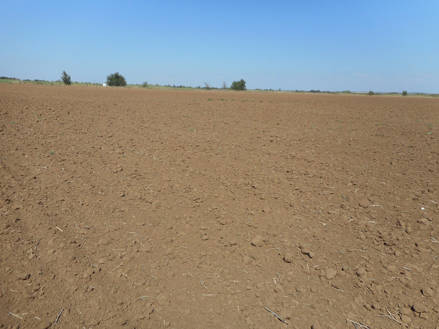
Weed forbs on a perennial fallow of the Raygorodsky irrigated area, Svetloyarsk Irrigation System, Volgograd Region, June 2016 (photo by I.N. Gorokhova)
Ley in the “Chervlenoe” irrigated area, Svetloyarsk Irrigation System, Volgograd Region, August 2017 (photo by I.N. Gorokhova)
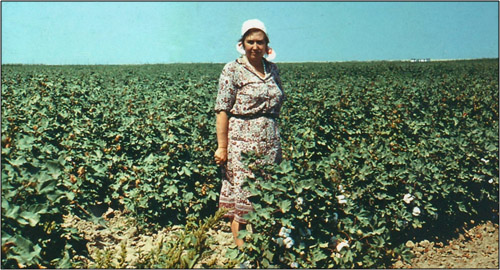
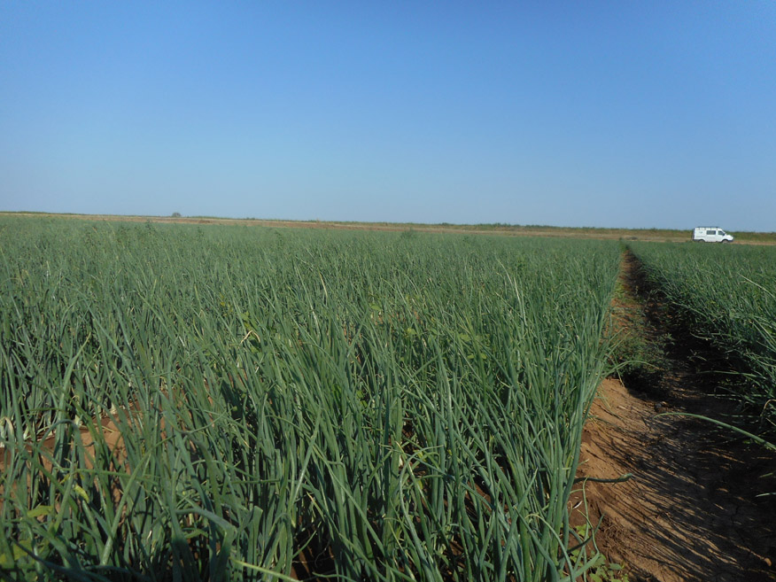
Onion growing in the irrigated fields of the Duboovrazhny irrigated area, Svetloyarsk Irrigation System, Volgograd Region, July 2018 (photo by I.N. Gorokhova)
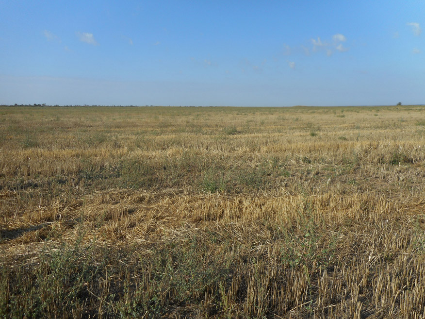
Withered stubble of harvested wheat on an irrigated field of the Volga-Don Irrigation System, Volgorad Region, September 2019 (photo by I.N. Gorokhova)

In this article we present the materials of studies that were carried out in the Volgograd Region. They can be used as the basis for methodological recommendations to map and determine the area and condition of irrigated lands using satellite images. They were obtained during the long-term researches in the irrigated lands in the Volgograd Region that took place on solonetz complexes in the dry steppe. Satellite imagery will help to map and determine 1) the areas of irrigated lands, 2) the areas and age of fallow lands in irrigated territories, 3) the state of irrigated soils and factors that limit their fertility. Crops growing in different hydrogeological conditions react differently to those limiting factors. Therefore, to compile a map it is recommended to adhere to such stages as identifying fields with different crops and fallow lands; highlighting patches in the images with sparse or absent crops; on the basis of field researches and analyzed soil samples, establishing the cause of the patchiness; selecting an algorithm for processing satellite images based on the results of field researches. The patchiness of irrigated fields, reflected in the images, can have a different origin, so their interpretation requires a mandatory study of the characteristics of the chosen area. Patchiness associated with secondary and residual salinization of soils is determined by the state of vegetation; therefore, the pictures should be taken during the period of high vegetative activity of plants. Among other things, it is necessary to obtain data on the level of groundwater, because its critical level is the main cause of secondary salinization. For deeply saline soils, it is necessary to build a salt map using interpolation of point data that was obtained in the field and laboratory. Patchiness associated with the carbonate content in the surface horizon does not depend on the level of groundwater and is best seen on the images showing an open soil surface. The accuracy of the map is checked by comparing it with maps of a larger scale and field observations, as well as by evaluating the accuracy of the classification of the image by determining the verification indexes. The materials presented in our article are intended for a wide range of specialists who use space information in their work, as well as for soil scientists, agronomists and chemists who work in agriculture in the southern regions of Russia.

Keywords: dry steppe zone, irrigated lands, saline soils, satellite imagery, mapping of irrigated soils.

Funding. This work was carried out for the State Assignment No. 0439-2022-0009 “To Study the Transformation, Evolution and Degradation of the Soil Cover of Agricultural Landscapes at Different Organizational Levels, Including Intra-field Heterogeneity Using a Combination of Ground Surveys and Digital Technologies”.

DOI: 10.24412/2542-2006-2023-1-38-65

EDN: BLIRXH

Метки: dry steppe zone, irrigated lands, mapping of irrigated soils, saline soils, satellite imagery

MILESTONES OF E.I. PANKOVA’S RESEARCH OF SALT SOILS

Ecology and dynamics Опубликовано 4 июля, 2022 автором admin1 октября, 2022

Yamnova  I.A. MILESTONES OF E.I. PANKOVA’S RESEARCH OF SALT SOILS // Ecosystems: Ecology and Dynamic. No. 2. 2022. P. 5-71. | Abstract | PDF | Reference |


E.I. Pankova
E.I. Pankova and I.S. Mikhailov on a community work day in 1953; the Moscow State University building under construction can be seen behind them
On the expedition to Central Asia, 1954

E.I. Pankova on her first expedition to Eastern Siberia, 1956
E.I. Pankova on an expedition to Eastern Mongolia, 1960
E.I. Pankova on an expedition to the Mirzachoʻl Steppe (Uzbekistan), 1967
E.I. Pankova on an expedition to the Gobi Desert (Mongolia), 1978

Evgenia Ivanovna Pankova (third from the left) and Natalia Ivanovna Bazilevich (second from the left) at the conference in Cairo (Egypt), 1972
E.I. Pankova on a cotton field in the Mirzachoʻl Steppe (Uzbekistan), 1985
E.I. Pankova at the meeting of the Academic Council at V.V. Dokuchaev Soil Institute
E.I. Pankova at the Faculty of Geography of M.V. Lomonosov Moscow State University

This article is dedicated to the career of the soil scientists and geographer, Evgeniya Ivanovna Pankova, who has been studying genesis, geography and evolution of saline soils her entire life. She graduated from the Moscow State University, Faculty of Geography, under the supervision of M.A. Glazovskaya, who inspired her love for arid soils. Six years of work at the Giprovodhoz Institute that included a lot of expeditions to Eastern Siberia, Moldova, Azerbaijan and Mongolia, gave E.I. Pankova a precious experience in the field of ameliorative soil science. After finishing her postgraduate study and completing her PhD thesis, from 1964 to the present day Evgenia Ivanovna has been working in the Department of the Genesis and Reclamation of Saline Soils at V.V. Dokuchaev Soil Institute. E.I. Pankova is the leading scientist of the Soil Institute. For many years she has been developing main areas of soil science, related to geography, genesis, cartography and classification of saline soils in arid regions of Russia and the countries of Central and Central Asia, as well as Mongolia and China. One of the most significant discoveries in her doctoral thesis was the conclusion E.I. Pankova made about the manifestation and inevitability of salt accumulation process in the hydromorphic landscapes of arid territories, especially during irrigation. Her work with N.I. Bazilevich resulted in creation of methodological guidelines for saline soils accounting, as well as maps of chemism types of soil salinity; they are widely used for scientific and practical purposes. E.I. Pankova is one of the founders of a remote method for studying soil salinity. She made a great contribution to the study of anthropogenic impact on geography, genesis and evolution of saline soils. E.I. Pankova is the author and executive editor of the monograph “Saline Soils of Russia”, which is the first major and generalized work on the soil salinization in Russia. Scientific activities of E.I. Pankova are recognized worldwide; she is a member of the International Society of Soil Scientists, the European Society for Soil Conservation. She is the founder of a scientific school that studies and maps saline soils. She has published more than 300 works, including 7 monographs.

Keywords: soil scientists, E.I. Pankova, saline soils, science contribution.

DOI: 10.24412/2542-2006-2022-2-5-71

EDN: BWNKHV

Метки: E.I. Pankova, saline soils, science contribution, soil scientists

About the Journal

  • General Information
  • Open Access
  • Editorial Board
  • Editorial Policy
  • Editorial Ethics

Submission of the Articles

  • Guideline for writing an article
  • Guidelines for Submission
  • Guidelines for Design
  • Guidelines for Abstract

Reviewing

  • Guidelines for Reviews

Archive

  • Opening Statement of the Editor-in-Chief
  • Articles
    • Articles. No.3, 2019
    • Articles. No.4, 2019
    • Articles. No.1, 2020
    • Articles. No.2, 2020
    • Articles. No.3, 2020
    • Articles. No.4, 2020
    • Articles. No.1, 2021
    • Articles. No.2, 2021
    • Articles. No.3, 2021
    • Articles. No.1, 2023
    • Articles. No.2, 2023
    • Articles. No.3, 2023
    • Articles. No.4, 2023
    • Articles. No.1, 2024
    • Articles. No.2, 2024
    • Articles. No.3, 2024
    • Articles. No.4, 2024
    • Articles. No.1, 2025
    • Articles. No.2, 2025
    • Articles. No.3, 2025
    • Articles. No.4, 2025
  • Issues
    • Issues for 2017
    • Issues for 2018
    • Issues for 2019
    • Issues for 2020
    • Issues for 2021
    • Issues for 2022
    • Issues for 2023
    • Issues for 2024
    • Issues for 2025
    • Issues for 2026
  • Photos
  • Events
©2026 - Ecology and dynamics - Weaver Xtreme Theme
↑