

Gorokhova I.N., Khitrov N.B., Kravchenko E.I. Dynamic Changes in the Area with Surface-Carbonate Soils Observed on Remote Sensing Data in the Volgograd Region // Ecosystems: ecology and dynamics. No 2. 2026. P. 41-60. | Abstract | PDF | Reference
-
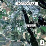
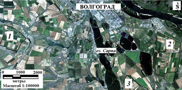
- Irrigated areas with studied fields that have patches of surface carbonate, on a Landcat-8 OLI image (26/05/1989)
-
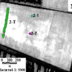
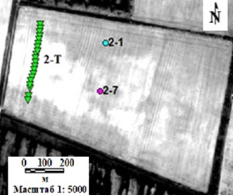
- A field in the “Svetloyarsky” irrigated area with sampling points and transect 2-T, which included regular sampling in 2015-2016, on a Pleiades image (20/05/2015)
-
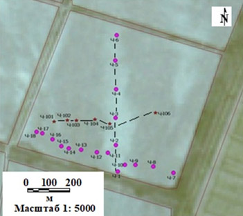
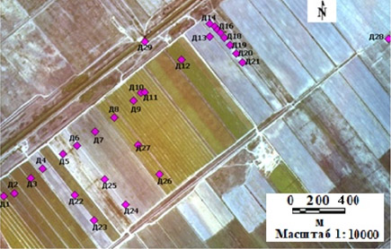
- Fields in the “Duboovrazhny” irrigated area with sampling points on a Resurs-P image (August 2018)
We studied the dynamics of changing area of surface carbonate soils with the help of satellite images over a 30-year period of irrigation in 3 key areas that belong to different natural zones of the Volgograd Region: 1) the Northern Yergeni Upland (“Chervlenoe” massif), 2) the Caspian Depressiom, Khvalynsk Clay Plain – Northern Sarpa Lowland (Svetloyarsky massif), 3) the Caspian Depressiom, Khvalynsk Clay Plain – Sarpa Gully (Duboovrazhny massif). All 3 sites are located in the dry-steppe zone with an initial soil cover of light-chestnut solonetzic complexes. They differ in elevation, relief, parent and underlying rocks, groundwater levels, alkalinity, soil salinity, and the history of anthropogenic impacts associated with field planning, groundwater level rise, methods of plowing and irrigation, and crops. All sites have surface-carbonate soils, which were additionally confirmed by our fieldwork and laboratory data. We used Landsat-5 and Landsat-8 OLI satellite images for the period of 1985-2018 with a ground resolution of 30 m. Iindividual fields in the images were selected where surface patches were most evident, formed by the carbonates in the arable soil horizon (0-30 cm). The patches were analyzed for 3 different years, with intervals of 5-18 years. When processing images, we identified surface carbonate soils visually, interactively, and by unsupervised image classification that uses the IsoData method in the ENVI software package. These methods yielded different results, with a similar trend of growing areas of patched over the years, which may be caused by the following reasons: 1) the spreading of carbonates across the field during annual plowing, 2) the settling of carbonates that come from carbonate-saturated soil solutions during evaporation and water use by plant roots, 3) the plowing of carbonate horizons as the arable horizon gets eroded. According to the image classification method, the greatest increase in area is observed in the fields of the “Chervlenoe” (12.6 ha) and Svetloyarsky (11.0 ha) massifs over 23 and 33-year periods, respectively. In the fields of the Duboovrazhny massif, the increase was 4.2 ha over 11 years, since the planning of the fields during the construction of the irrigation system there was insignificant, and the period under consideration was shorter (11 years).
Keywords: light chestnut soils, irrigation, soil carbonates, field planning, space imagery classification, soil cover heterogeneity.
DOI: 10.24412/2542-2006-2026-2-41–60
EDN: YHZZYA