Gorokhova I.N., Chursin I.N., Khitrov N.B., Kruglyakova N.K. Satellite Data to Help Distinguish Calcareous Soils in the Volga-Don Irrigation System, Volgograd Region // Ecosystems: ecology and dynamics. No 1. 2023. P. 92-114. | Abstract | PDF | Reference
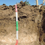
- Open soil surface of the Volga-Don irrigation system, August 2020 (photo by N.B. Khitrov)
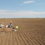
- Light spots of surface-calcareous soils visible on the arable horizon, Volga-Don irrigation system, August 2020 (photo by N.B. Khitrov)
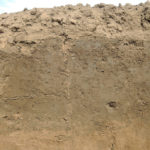
- Burst bubbles of calcareous soils effervescence caused by HCl solution can be seen in the center of the image, August 2020 (photo by N.B. Khitrov)
- Sunset in the dry steppe of the Volgorad Region, September 2019 (photo by I.N. Gorohova)
In this study we substantiate the importance of identification of the areas with calcareous soils on the key plot of the “Oroshayemaya” experimental station that belongs to the Volga-Don irrigation system, Volgograd Region, using high-resolution satellite data (Pleiades). Carbonates in soils have both a positive and a negative impact; therefore, it is important to identify such soils. We identified calcareous areas on the satellite images, judging by the spots of various degrees of soil effervescence on the surface, caused by HC1 solution, which, in its turn, was detected via the contact method in the cultivated fields. After that we determined a relationship between the spectral brightness of soil effervescence in different channels of the satellite image and its degree. In order to do this, we took a sample of pixels from the images that corresponded to the patches of surface effervescence in the terrain that was previously used in the Random Forest algorithm to select classes in the image. The results showed that identification of the areas with surface layer of calcareous soils (soil effervescence), using satellite data, will be the most optimal if the field research and the survey data took place during the dry season of the year, i.e. from May to July.
For image processing the images of open fields should be used, while the undeveloped ones should be ignored. It is also necessary to exclude patches of meadow and meadow-chestnut soils from the sample, since they are usually located in depressions and can interfere with calculations due to the carbonates that flow in from the side. It is best to allocate the areas of calcareous soils within a single field or within a group of fields with similar brightness level; different brightness levels indicate different types of land use, such as dry farming and irrigated fields. Such a differentiated approach allows the precision of soils classification on the satellite image reach 0.75-0.90, based on the degree of their effervescence (no effervescence, weak, average, strong). However, when the entire key plot is processed, only the soils with “strong effervescence” or “no effervescence” can be identified with the precision of 0.7. The novelty of our work results lies in the substantiation of the possibility to reliably identify (while following all the requirements) calcareous soils on the ground surface by using high-resolution satellite data together with field survey data.
Keywords: calcareous soils, soil effervescence, degree of soil effervescence, open surface, satellite imagery, spectral brightness, classification precision, Volgograd Region.
Funding. This work was carried out for the state assignments No. 0439-2022-0009 “To Study the Transformation, Evolution and Degradation of the Soil Cover in the Agricultural Landscapes at Different Levels of Organization, Including the Heterogeneity of Their Fields and Using Ground Surveys along with Digital Technologies”.
DOI: 10.24412/2542-2006-2023-1-92-114
EDN: CXMSUO


