
ANALYSIS, EVALUATION AND WAYS FOR RATIONAL LAND MANAGEMENT OF NORTH VIETNAM (SUOI SAP CATCHMENT BASIN)
Demidov V.V., Shchegolkova N.M., Vo Dai Hai, Phung Van Khoa, Bao Huy ANALYSIS, EVALUATION AND WAYS FOR RATIONAL LAND MANAGEMENT OF NORTH VIETNAM (SUOI SAP CATCHMENT BASIN) // ECOSYSTEMS: ECOLOGY AND DYNAMICS, 2019, Vol. 3, No. 3, Pp. 116-124 | Abstract | PDF | Reference |
-

- Agricultural lands management (photo by V.V. Demidov)

-

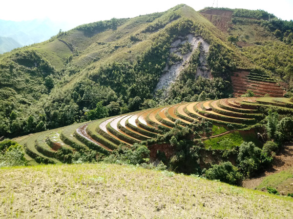
- Water catchment basin of the Suoi Sap rive; agricultural management of the hillside lands (photo by V.V. Demidov)
-

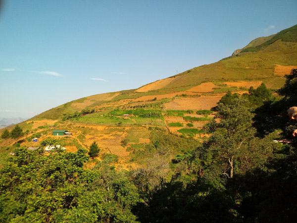
- Agricultural management of the hillside lands near Ban Kha town (photo by V.V. Demidov)
-

- Artificial reservoirs for the rainfall accumulation (photo by V.V. Demidov)

-

- Irrigation performed with the accumulated water (photo by V.V. Demidov)

-

- Corn seeding on a steep slope (photo by V.V. Demidov)

-

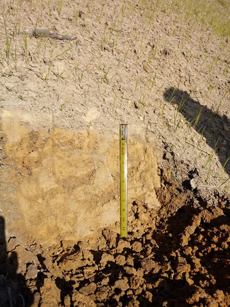
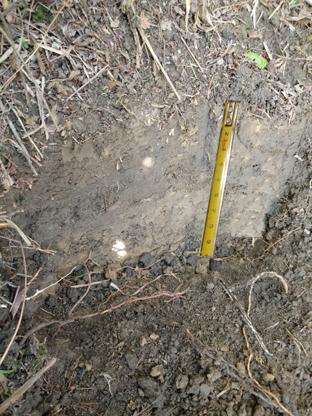
- Eroded soil (photo by V.V. Demidov)
-

- Non-eroded soil (photo by V.V. Demidov)
-

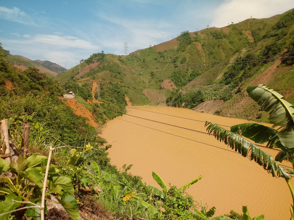
- Color of the Da river depends on the washed-off soil (photo by V.V. Demidov)
-

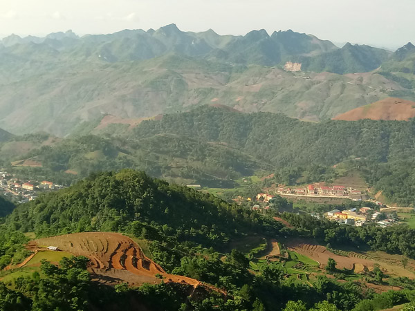
- Management of the suburban territory of Ban Kha town for the growth of agricultural species (photo by V.V. Demidov)

In this article we present the analysis of practical and economical use of the territory of Suoi Sap catchment basin, Son-La province, Vietnam. We used the data of a route survey, performed by the Vietnam National Forestry University, for the assessment. We analyzed the climatic conditions, soil and vegetation resources, and economical use of the territory. The research territory is located in the Northern, mountainous part of Vietnam. It was determined that the slopes of the length from 500 to 2000 m (87%) with steepness from 10° to 40° (90%) prevail in the catchment area. The amount of precipitation (rain) is more than 1750 mm, with most of them falling in summer-autumn (May-September). This leads to the spread of erosion processes, an increase of polluted and degraded lands. In this regard, the organization of rational and efficient use of land should include the creation of optimal conditions for the reproduction and protection of soil fertility, increasing its role in agricultural production. The scientifically based analysis of the impact of natural and other factors on the state of land resources of the catchment area allows us to recommend the use of the most rational and correct criteria and methods of land use in the area. In general, the solution of this problem for similar territories of Vietnam requires the definition of criteria for the ecological and economic efficiency of land use, the analysis of land use, the development of a scientific and methodological approach to the qualitative assessment of land use control in the context of the development of an agrarian economy. WOCAT system has been used in the development of effective watershed land-use technologies.
Keywords: Vietnam, rational lands management, catchment basin, WOCAT.
DOI: 10.24411/ 2542-2006-2019-10044